
Related Images


Download:
| Tiny | 157x128 | View | Download |
| Small | 314x256 | View | Download |
| Medium | 629x512 | View | Download |
| Large | 1258x1024 | View | Download |
| Original | 6012x4890 | View | Download |
This image was acquired from
wikimedia. It was marked as Public Domain or CC0 and is free to use. To verify, go to the source and check the information there.
Looking for more info about this image?
Try a Google Reverse Image Search for it.
Try a Google Reverse Image Search for it.
Keywords from Image Description:
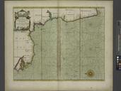
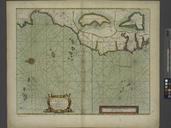
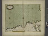
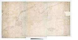
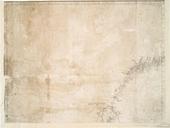
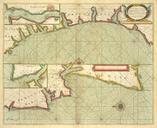
A sea chart of part of the coasts of GALLISIA and PORTUGALL from Cape de Finistrre to the Burlings and from the Burlings to Cape de St. Vincent NYPL b. inserted in Sabin and Phillips Insets of Lisbon and Porta Port nypl org Scan by NYPL sea chart of part of the coasts of GALLISIA and PORTUGALL from Cape de Finistrre to the