Related Images


Download:
| Tiny | 182x128 | View | Download |
| Small | 365x256 | View | Download |
| Medium | 730x512 | View | Download |
| Large | 1461x1024 | View | Download |
| Original | 2400x1681 | View | Download |
This image was acquired from
wikimedia. It was marked as Public Domain or CC0 and is free to use. To verify, go to the source and check the information there.
Looking for more info about this image?
Try a Google Reverse Image Search for it.
Try a Google Reverse Image Search for it.
Keywords from Image Description:
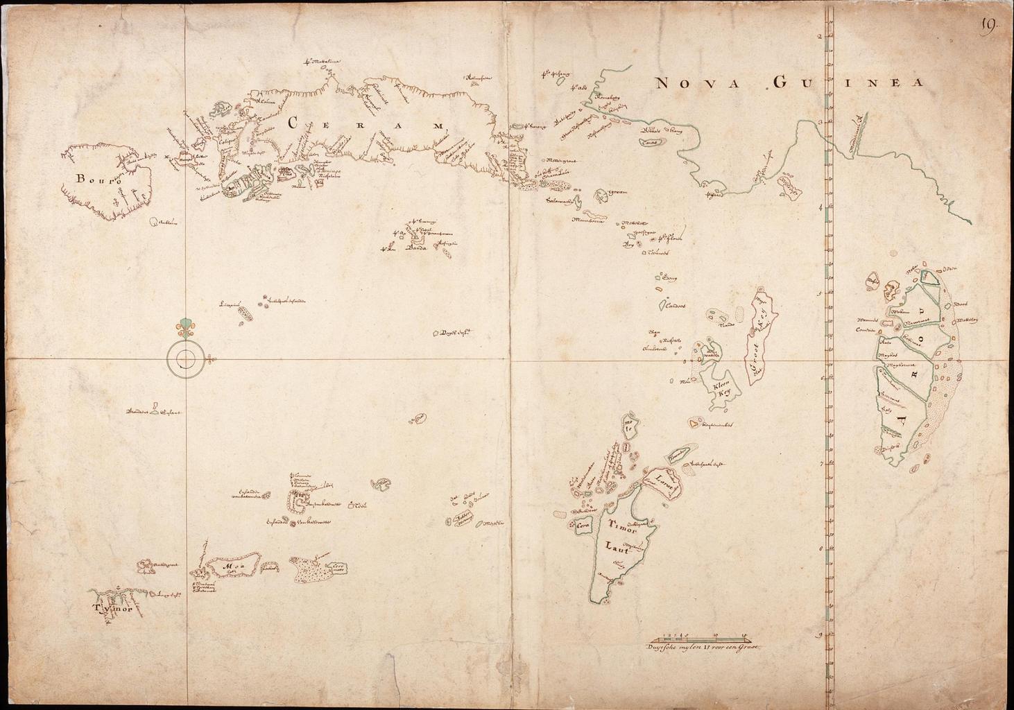
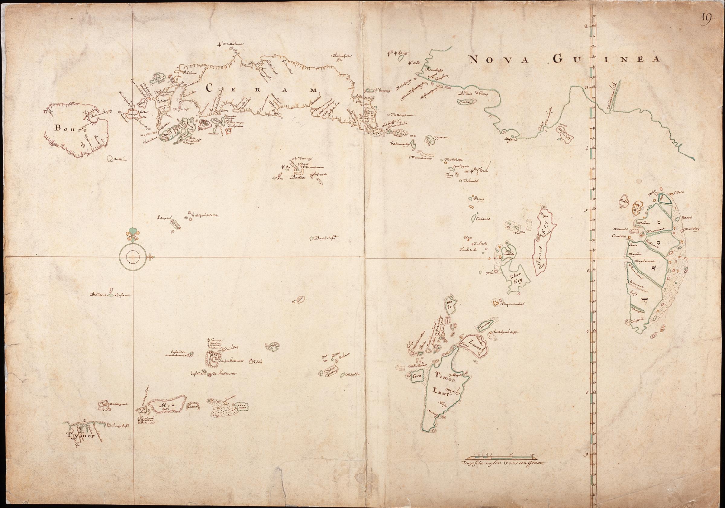
AMHNA Map of Seram and the region south east of Seram. Artwork nl Kaart van Seram en het gebied ten zuidoosten van Seram nl Titel in catalogus Leupe Nationaal Archief Kaart van het Eiland Ceram Bouro een gedeelte van de Westkust van Nova Guinea de Arouw Eilanden Timorlaut het Oostelykste gedeelte van Tymor en de daartusschen gelegen