
Related Images
Download:
| Tiny | 157x128 | View | Download |
| Small | 315x256 | View | Download |
| Medium | 630x512 | View | Download |
| Large | 1261x1024 | View | Download |
| Original | 2400x1948 | View | Download |
This image was acquired from
wikimedia. It was marked as Public Domain or CC0 and is free to use. To verify, go to the source and check the information there.
Looking for more info about this image?
Try a Google Reverse Image Search for it.
Try a Google Reverse Image Search for it.
Keywords from Image Description:
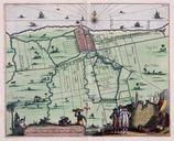
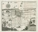
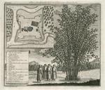
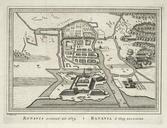
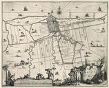
AMHKB Map of Batavia and environs. Artwork nl Kaart van Batavia en omgeving nl Kaart van Batavia en omgeving Landt Caerte van Batavia met Haer onder hoorende Forten Dit is de zwartwit uitvoering van Koninklijke Bibliotheek Atlas van der Hagen Deel inv nr Aangepaste kopien zijn Tropenmuseum KIT inv nr Westfries Museum inv nr en