
Related Images


Download:
| Tiny | 191x128 | View | Download |
| Small | 383x256 | View | Download |
| Medium | 766x512 | View | Download |
| Large | 1533x1024 | View | Download |
| Original | 1622x1083 | View | Download |
This image was acquired from
wikimedia. It was marked as Public Domain or CC0 and is free to use. To verify, go to the source and check the information there.
Looking for more info about this image?
Try a Google Reverse Image Search for it.
Try a Google Reverse Image Search for it.
Keywords from Image Description:
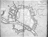
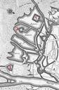
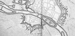
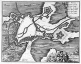
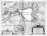
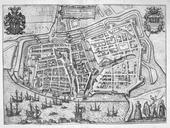
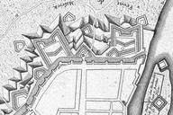
Atlas BeudekerCE XPLAN DE MAESTRICHBossche Fronten . en Detail of French map of the fortifications of Maastricht the Netherlands published in in Paris This section shows the northern part of the fortifications the socalled Bossche Fronten org AtlasBeudekerCEXPLANDEMAESTRICH jpeg Unknown cartographer Publisher Baillieux Paris