Related Images
Download:
| Tiny | 229x128 | View | Download |
| Small | 458x256 | View | Download |
| Medium | 916x512 | View | Download |
| Large | 1833x1024 | View | Download |
| Original | 5269x2943 | View | Download |
This image was acquired from
wikimedia. It was marked as Public Domain or CC0 and is free to use. To verify, go to the source and check the information there.
Looking for more info about this image?
Try a Google Reverse Image Search for it.
Try a Google Reverse Image Search for it.
Keywords from Image Description:
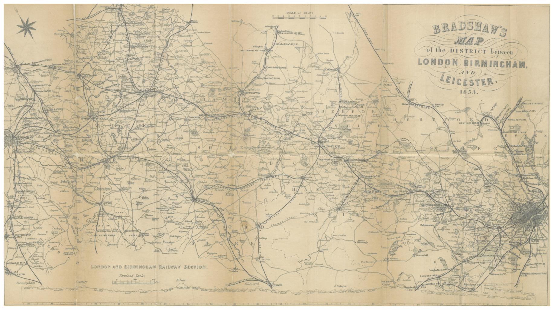
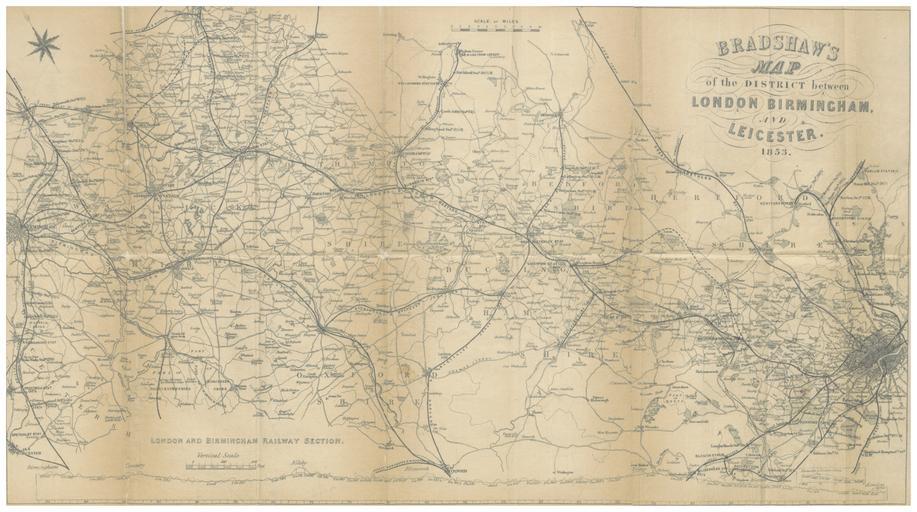
BRADSHAW MAP OF THE DISTRICT BETWEEN LONDON BIRMINGHAM AND LEICESTER. object history credit line accession number British Library HMNTS Image extracted from page of Bradshaw's HandBook to the Manufacturing Districts of Great Britain by BRADSHAW George Original held and digitised by the British Library Copied from Note The