Related Images


Download:
| Tiny | 136x128 | View | Download |
| Small | 273x256 | View | Download |
| Medium | 546x512 | View | Download |
| Large | 1093x1024 | View | Download |
| Original | 7096x6647 | View | Download |
This image was acquired from
wikimedia. It was marked as Public Domain or CC0 and is free to use. To verify, go to the source and check the information there.
Looking for more info about this image?
Try a Google Reverse Image Search for it.
Try a Google Reverse Image Search for it.
Keywords from Image Description:
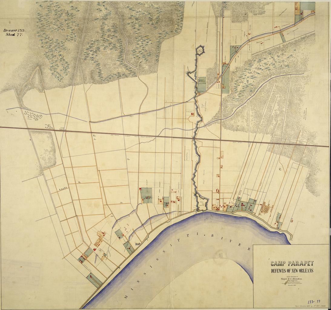
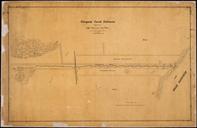
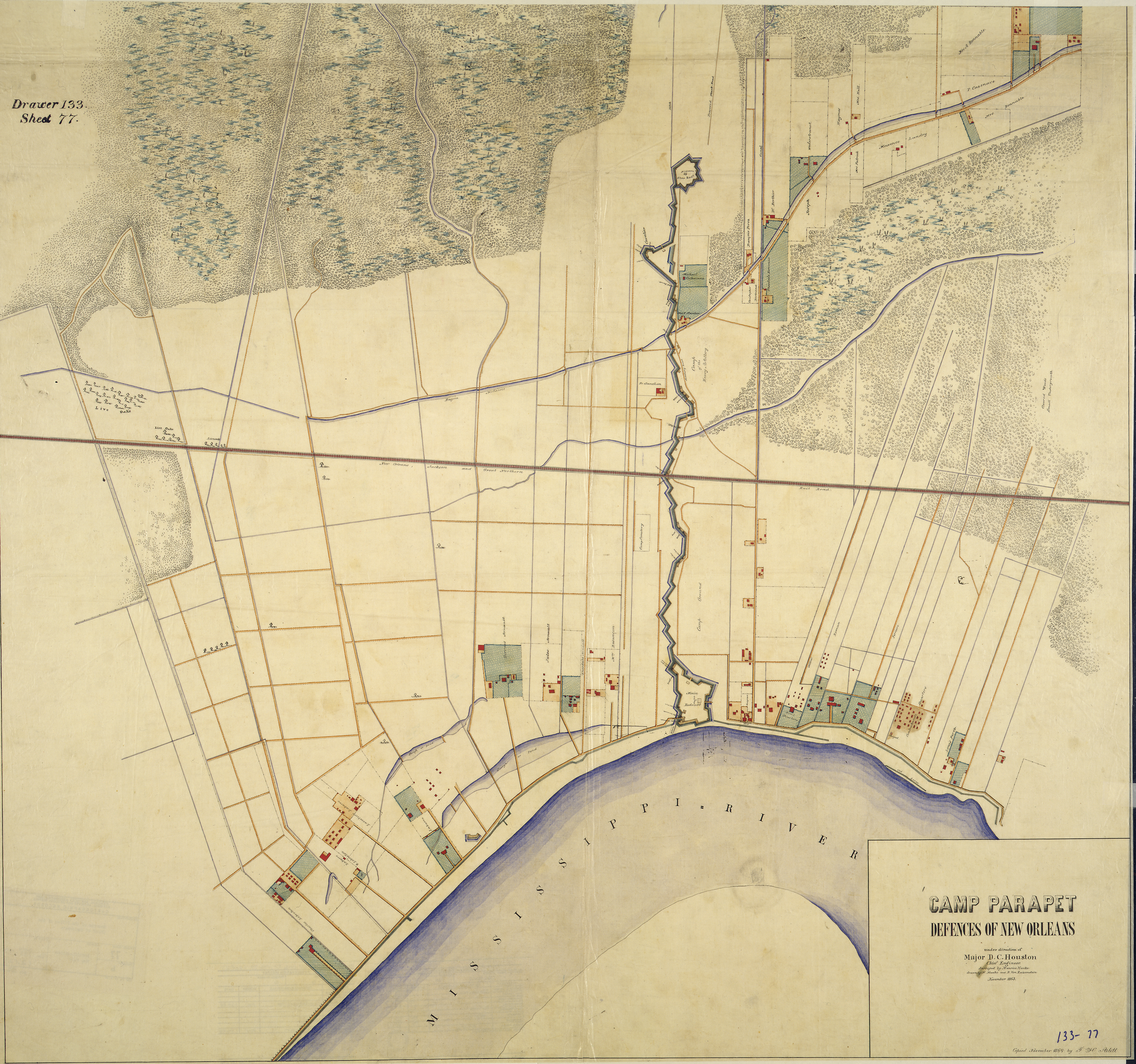
CampParapetMap. Map of American Civil War forifications upriver from New Orleans Louisiana Camp Parapet and vicinity Defences of New Orleans Compiled under direction of Major Houston Chief Engineer Surveyed by Maurice Hauke drawn by Hauke and Von Reizenstein November Copied November by Arlitt map via umiacs umd edu pl item Hauke