Related Images


Download:
| Tiny | 158x128 | View | Download |
| Original png | 262x212 | View | Download |
| Original as jpg | 262x212 | View | Download |
This image was acquired from
wikimedia. It was marked as Public Domain or CC0 and is free to use. To verify, go to the source and check the information there.
Looking for more info about this image?
Try a Google Reverse Image Search for it.
Try a Google Reverse Image Search for it.
Keywords from Image Description:
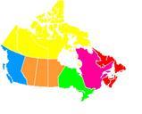
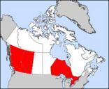
Canada provinces blank vide. This is actually the same believe it or not as Image British Columbiamap which is in the public domain according to its creator it's Lambert Azimuthal projection I've just done lot of monkeying with the colours QuartierLatin September UTC Qu'on le croit ou pas cet image est en fait le mme que Image