
Related Images


Download:
| Tiny | 145x128 | View | Download |
| Small | 290x256 | View | Download |
| Medium | 580x512 | View | Download |
| Large | 1161x1024 | View | Download |
| Original png | 1280x1128 | View | Download |
| Original as jpg | 1280x1128 | View | Download |
This image was acquired from
wikimedia. It was marked as Public Domain or CC0 and is free to use. To verify, go to the source and check the information there.
Looking for more info about this image?
Try a Google Reverse Image Search for it.
Try a Google Reverse Image Search for it.
Keywords from Image Description:
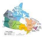
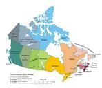
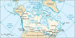
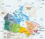
Carte administrative du Canada. Carte politique du Canada en franais en Image MapCanadapoliticalgeo drawn and adapted by Pluribus Anthony from gc ca Atlas of Canada Original file March br version August Original file Pluribus Anthonybr version Sting with translation indication by fr User Boral Public domain Image MapCanadapoliticalfr