Related Images


Download:
| Tiny | 194x128 | View | Download |
| Small | 388x256 | View | Download |
| Medium | 776x512 | View | Download |
| Original | 1299x857 | View | Download |
This image was acquired from
wikimedia. It was marked as Public Domain or CC0 and is free to use. To verify, go to the source and check the information there.
Looking for more info about this image?
Try a Google Reverse Image Search for it.
Try a Google Reverse Image Search for it.
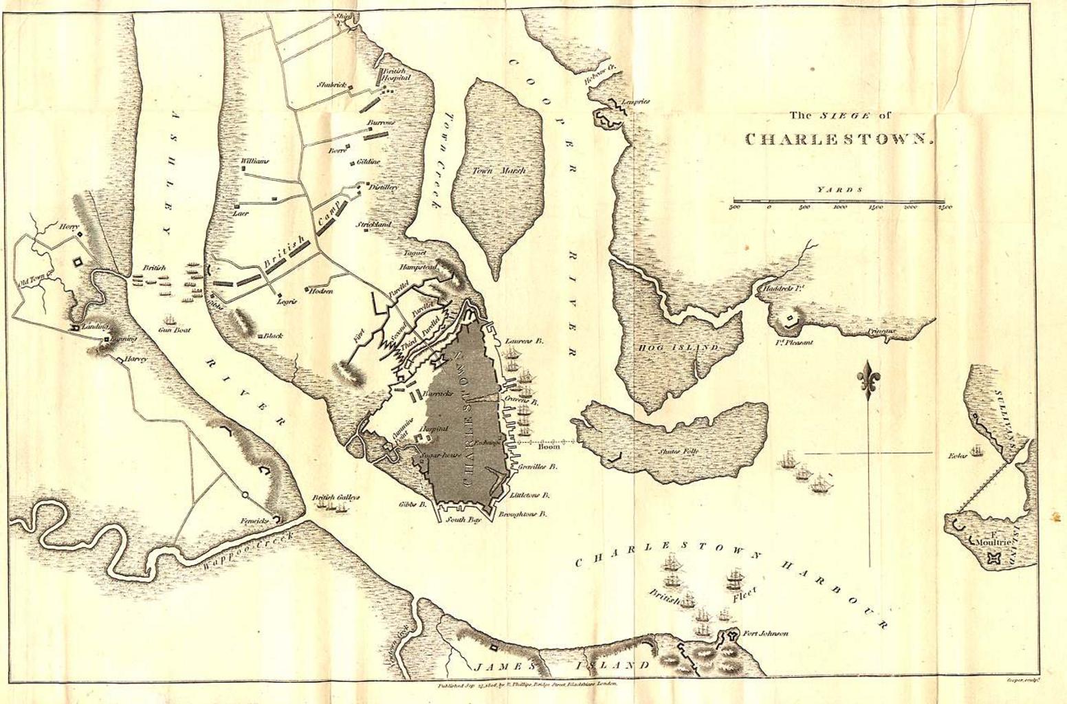
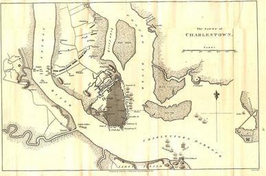
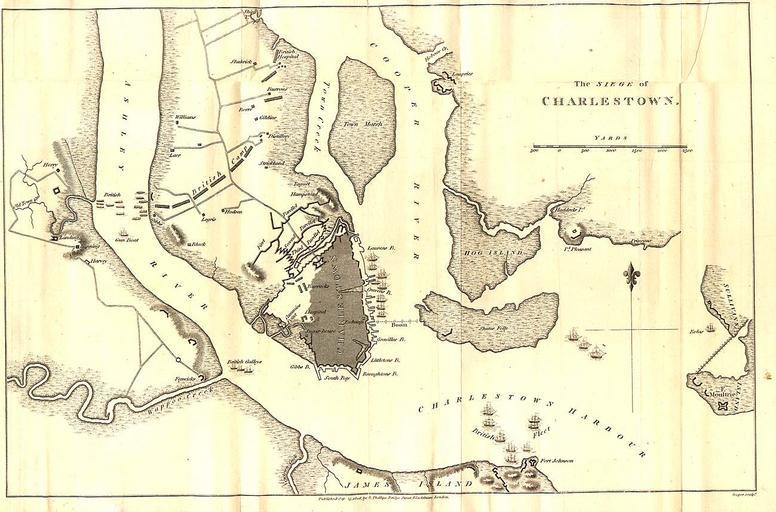
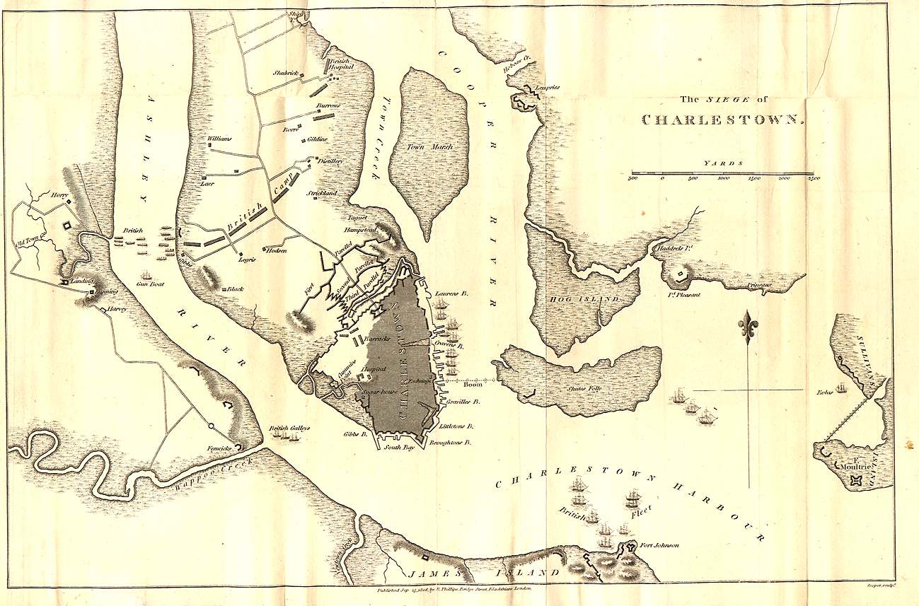
Keywords from Image Description:
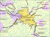
Charlestownmap.jpeg map of Charleston detailing the British siege in earlyamerica jpeg Appears to have been published on September by an Phillips but cannot tell for certain what it says The year is either or See above PDold Old maps of Charleston South Carolina