Download:
| Tiny | 100x128 | View | Download |
| Small | 201x256 | View | Download |
| Medium | 402x512 | View | Download |
| Original | 548x697 | View | Download |
This image was acquired from
wikimedia. It was marked as Public Domain or CC0 and is free to use. To verify, go to the source and check the information there.
Looking for more info about this image?
Try a Google Reverse Image Search for it.
Try a Google Reverse Image Search for it.
Keywords from Image Description:
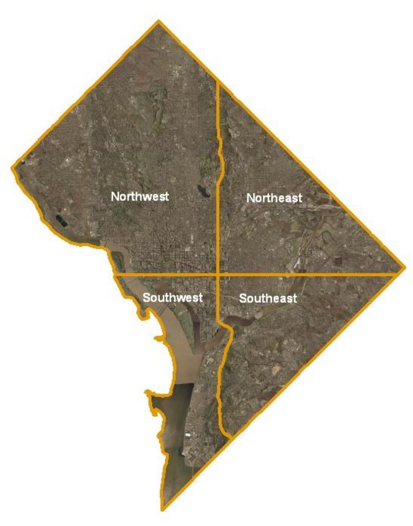
DCQUADS. taken from the english original text USGS satellite image of Washington DC taken April The Potomac River and its eastern branch the Anacostia River are visible Virginia lies across the Potomac from Washington while Maryland surrounds it on all other sides The orange lines in the image mark the quadrant divisions of Washington
