
Related Images

Download:
| Tiny | 147x128 | View | Download |
| Small | 294x256 | View | Download |
| Medium | 589x512 | View | Download |
| Large | 1178x1024 | View | Download |
| Original | 5611x4874 | View | Download |
This image was acquired from
wikimedia. It was marked as Public Domain or CC0 and is free to use. To verify, go to the source and check the information there.
Looking for more info about this image?
Try a Google Reverse Image Search for it.
Try a Google Reverse Image Search for it.
Keywords from Image Description:
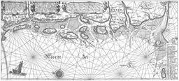
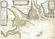
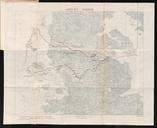
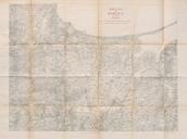
De Nordseekste Karten . Nieuwe Caerte waerinne vertoont wordt de gantsche Vaert van Amsterdam over de WATTEN tot de stadt Hamborch toe Tabula nova In qua accurata demonstratur tota Nacigatio abe AMSTELODAMI statione per vada vulgo de WATTEN HAMBURGUM usq scan from copy of the original cm cm Henricus Hondius PDold De Nordseekste