
Related Images


Download:
| Tiny | 105x128 | View | Download |
| Small | 211x256 | View | Download |
| Medium | 422x512 | View | Download |
| Large | 844x1024 | View | Download |
| Original png | 2300x2790 | View | Download |
| Original as jpg | 2300x2790 | View | Download |
This image was acquired from
wikimedia. It was marked as Public Domain or CC0 and is free to use. To verify, go to the source and check the information there.
Looking for more info about this image?
Try a Google Reverse Image Search for it.
Try a Google Reverse Image Search for it.
Keywords from Image Description:
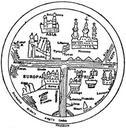
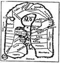
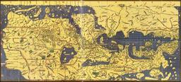
EB Map Fig . Fig AngloSaxon Map of the World th century From Cotton MS In Latin with East India and Taprobane Lanka at the top of the map Map in the Encyclopaedia Britannica thed Vol XVII anonymous Presumably Emery Walker PDUS PDBritannica PDArt other versions Cotton world map Original map PDUS PDArt PD PDBritannica thcentury