
Related Images


Download:
| Tiny | 164x128 | View | Download |
| Small | 329x256 | View | Download |
| Medium | 659x512 | View | Download |
| Large | 1319x1024 | View | Download |
| Original | 3807x2954 | View | Download |
This image was acquired from
wikimedia. It was marked as Public Domain or CC0 and is free to use. To verify, go to the source and check the information there.
Looking for more info about this image?
Try a Google Reverse Image Search for it.
Try a Google Reverse Image Search for it.
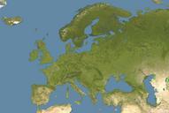
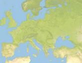
Keywords from Image Description:
Europe satellite image location map Britain To Turkey. Positionskarte von Europa Satellitenbild Quadratische Plattkarte NSStreckung Geographische Begrenzung der Karte Location map of Europe satellite image Equirectangular projection stretching Geographic limits of the map Europesatelliteimagelocationmap UTC Europesatelliteimagelocationmap