
Related Images


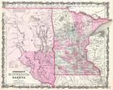


Download:
| Tiny | 169x128 | View | Download |
| Small | 339x256 | View | Download |
| Medium | 679x512 | View | Download |
| Large | 1359x1024 | View | Download |
| Original png | 1814x1366 | View | Download |
| Original as jpg | 1814x1366 | View | Download |
This image was acquired from
wikimedia. It was marked as Public Domain or CC0 and is free to use. To verify, go to the source and check the information there.
Looking for more info about this image?
Try a Google Reverse Image Search for it.
Try a Google Reverse Image Search for it.
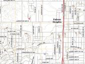
Keywords from Image Description:
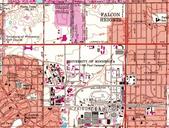
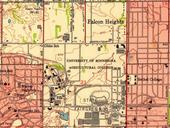
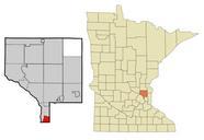
Falcon Heights Minnesota map . en USGS scale Quadrangle for St Paul West MN The National Map United States Geological Survey other versions PDUSGov Falcon Heights Minnesota