
Related Images

Download:
| Tiny | 136x128 | View | Download |
| Small | 272x256 | View | Download |
| Medium | 544x512 | View | Download |
| Large | 1088x1024 | View | Download |
| Original svg | 2095x1970 | View | Download |
| Original as jpg | 2095x1970 | View | Download |
This image was acquired from
wikimedia. It was marked as Public Domain or CC0 and is free to use. To verify, go to the source and check the information there.
Looking for more info about this image?
Try a Google Reverse Image Search for it.
Try a Google Reverse Image Search for it.
Keywords from Image Description:
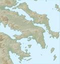
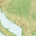
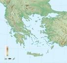
Greece large topographic basemap.svg Balkans incl Greece Albania Macedonia Aegean and western Anatolia Blank topographic basemap coastlines water bodies as per SWBD elevation contours from SRTM Modern international boundaries added from VMAP Coverage Projection Lambert Conformal Conic Lon Lat Lat Lat Relief coloring and shading