
Related Images


Download:
| Tiny | 156x128 | View | Download |
| Small | 313x256 | View | Download |
| Medium | 627x512 | View | Download |
| Large | 1254x1024 | View | Download |
| Original | 2331x1903 | View | Download |
This image was acquired from
wikimedia. It was marked as Public Domain or CC0 and is free to use. To verify, go to the source and check the information there.
Looking for more info about this image?
Try a Google Reverse Image Search for it.
Try a Google Reverse Image Search for it.
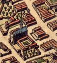
Keywords from Image Description:
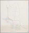
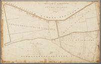
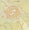
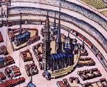
Groningen noordoostelijkdeel ca . Detail van een plattegrond van Groningen uit de stedenatlas van Georg Braun en Frans Hogenberg met Martinikerk Fraterhuis en SintWalburgkerk Detail of map of Groningen from the cityatlas by Georg Braun and Frans Hogenberg with Martinichurch Fraterhuis and SintWalburgchurch eigen scan uit Canon