
Related Images


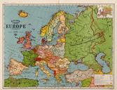


Download:
| Tiny | 178x128 | View | Download |
| Small | 356x256 | View | Download |
| Medium | 713x512 | View | Download |
| Original gif | 1014x728 | View | Download |
| Original as jpg | 1014x728 | View | Download |
This image was acquired from
wikimedia. It was marked as Public Domain or CC0 and is free to use. To verify, go to the source and check the information there.
Looking for more info about this image?
Try a Google Reverse Image Search for it.
Try a Google Reverse Image Search for it.
Keywords from Image Description:
Honfoglalas. Animated map of the first settlement of Hungarian populations in Europe in the th century years through See szentes hu htm Own Fz Maps of the Hungarian prehistory Maps of the history of Romania in the Middle Ages Maps of the history of Bulgaria in the Middle Ages Maps of Great Moravia Maps of the Khazars Animated