
Related Images

Download:
| Tiny | 107x128 | View | Download |
| Small | 215x256 | View | Download |
| Medium | 430x512 | View | Download |
| Large | 861x1024 | View | Download |
| Original | 2357x2803 | View | Download |
This image was acquired from
wikimedia. It was marked as Public Domain or CC0 and is free to use. To verify, go to the source and check the information there.
Looking for more info about this image?
Try a Google Reverse Image Search for it.
Try a Google Reverse Image Search for it.
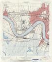
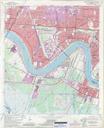
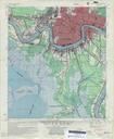
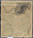
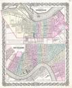
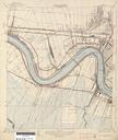
Keywords from Image Description:
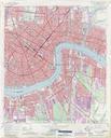
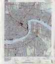
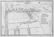
Jefferson Parish Louisiana Riverfront New Orleans Map . map of section of Greater New Orleans showing portion of Jefferson Parish along and near the Mississippi River including Old Jefferson Old Metarie Southport Harahan Shrewsbury Waggaman Avandale Nine Mile Point Belt City now Bridge City and Westwego also seen is small portion