Download:
| Tiny | 170x128 | View | Download |
| Small | 341x256 | View | Download |
| Medium | 682x512 | View | Download |
| Original | 1280x960 | View | Download |
This image was acquired from
wikimedia. It was marked as Public Domain or CC0 and is free to use. To verify, go to the source and check the information there.
Looking for more info about this image?
Try a Google Reverse Image Search for it.
Try a Google Reverse Image Search for it.
Keywords from Image Description:
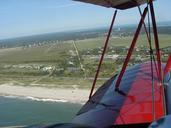
Katama South Beach. This is an aerial photograph taken in showing the Mattakessett area of Katama of Martha's Vineyard Island including South Beach The photo looks to the east Directly below is conservation land adjacent to the southern end of Katama Edgartown airfield The Mattakessett region of Katama is shown in the central portion

