
Related Images


Download:
| Tiny | 165x128 | View | Download |
| Small | 331x256 | View | Download |
| Medium | 663x512 | View | Download |
| Large | 1327x1024 | View | Download |
| Original | 4635x3576 | View | Download |
This image was acquired from
wikimedia. It was marked as Public Domain or CC0 and is free to use. To verify, go to the source and check the information there.
Looking for more info about this image?
Try a Google Reverse Image Search for it.
Try a Google Reverse Image Search for it.
Keywords from Image Description:
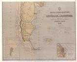
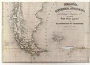
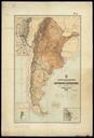
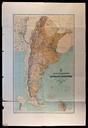
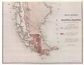
LaIlustracionArgentina. Parcial reproduction of the first argentinian map showing the boundaries laid down in the Boundary Treaty of July appeared in La Ilustracion Argentina issue of November in Buenos Aires The copy reproduced here is one handed to the British Minister Plenipontentiary in Buenos Aires by Dr Bernardo de Irigoyen