
Related Images


This image was acquired from
wikimedia. It was marked as Public Domain or CC0 and is free to use. To verify, go to the source and check the information there.
Looking for more info about this image?
Try a Google Reverse Image Search for it.
Try a Google Reverse Image Search for it.
Keywords from Image Description:
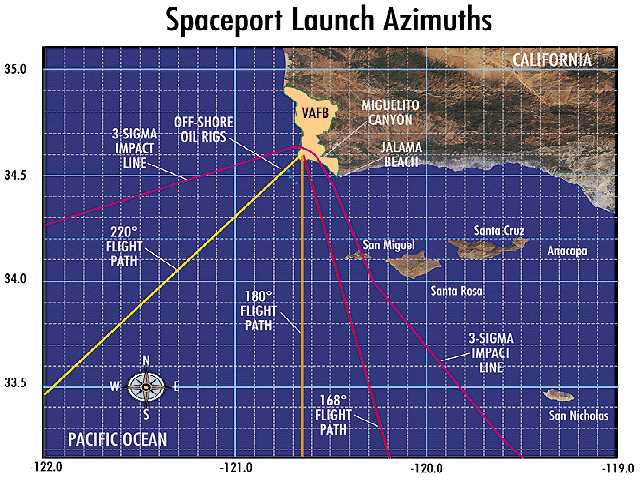
LaunchAzimuths. military map en October Map of possible launch azimuths from Vandenberg AFB in central California northern Santa Barbara county Image courtesy Space Systems International BadJPEG PDUSGov Original upload log page en LaunchAzimuths WSpaceport bytes no of possible launch azimuths from Vandenberg AFB in central