
Related Images


Download:
| Tiny | 93x128 | View | Download |
| Small | 186x256 | View | Download |
| Medium | 373x512 | View | Download |
| Large | 746x1024 | View | Download |
| Original | 1521x2086 | View | Download |
This image was acquired from
wikimedia. It was marked as Public Domain or CC0 and is free to use. To verify, go to the source and check the information there.
Looking for more info about this image?
Try a Google Reverse Image Search for it.
Try a Google Reverse Image Search for it.
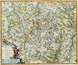
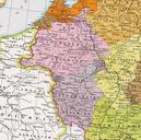
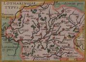
Keywords from Image Description:
Lotharingia. Premire carte connue de la Lorraine note Le nord est en bas First known map of Lorraine North is at bottom Erste bekannte Karte Lothringens Norden ist unten Bibliothque municipale de SaintDidesVosges catalogue de l'exposition America L'amrique est ne saintDidesVosges en Creator Martin Waldseemller PDold Maps of