
Related Images
Download:
| Tiny | 107x128 | View | Download |
| Small | 215x256 | View | Download |
| Medium | 430x512 | View | Download |
| Original png | 600x714 | View | Download |
| Original as jpg | 600x714 | View | Download |
This image was acquired from
wikimedia. It was marked as Public Domain or CC0 and is free to use. To verify, go to the source and check the information there.
Looking for more info about this image?
Try a Google Reverse Image Search for it.
Try a Google Reverse Image Search for it.
Keywords from Image Description:
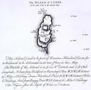
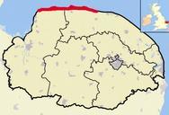
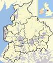
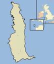
Lundy outline map. map of the Island of Lundy in the English Channel part of the United Kingdom selfmade using Adobe Illustrator and Photoshop Jhamez Maps of Lundy