Download:
| Tiny | 90x128 | View | Download |
| Small | 181x256 | View | Download |
| Medium | 362x512 | View | Download |
| Large | 724x1024 | View | Download |
| Original | 780x1102 | View | Download |
This image was acquired from
wikimedia. It was marked as Public Domain or CC0 and is free to use. To verify, go to the source and check the information there.
Looking for more info about this image?
Try a Google Reverse Image Search for it.
Try a Google Reverse Image Search for it.
Keywords from Image Description:
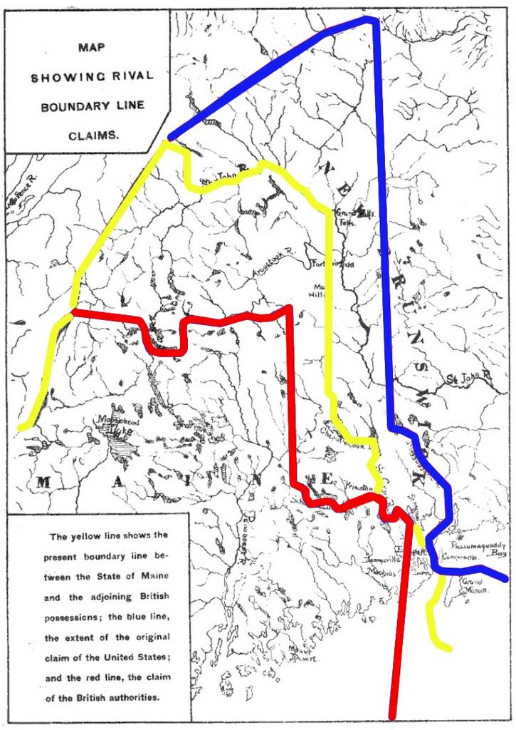
MaineBoundaryDispute. Map showing competing proposals for the boundary line between the US state of Maine and the British now Canadian province of New Brunswick The red line marks the British proposal the blue line marks the US proposal and the yellow line marks the line agreed in the WebsterAshburton Treaty which resolved virtually
