
Related Images


Download:
| Tiny | 170x128 | View | Download |
| Small | 341x256 | View | Download |
| Medium | 682x512 | View | Download |
| Original | 787x590 | View | Download |
This image was acquired from
wikimedia. It was marked as Public Domain or CC0 and is free to use. To verify, go to the source and check the information there.
Looking for more info about this image?
Try a Google Reverse Image Search for it.
Try a Google Reverse Image Search for it.
Keywords from Image Description:
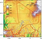
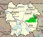
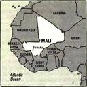
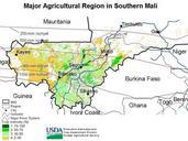
Mali ag map USDA. Major Agricultural Region in Southern Mali showing Isohyet lines and crop intesity percentages Mali most productive agricultural region located between Bamako and Mopti Irrigation is practiced in this region but irrigation water is used mainly for rice while cotton is grown as rainfed crop Average rainfall varies