
Related Images


Download:
| Tiny | 128x128 | View | Download |
| Small | 256x256 | View | Download |
| Medium | 512x512 | View | Download |
| Large | 1024x1024 | View | Download |
| Original svg | 2102x2102 | View | Download |
| Original as jpg | 2102x2102 | View | Download |
This image was acquired from
wikimedia. It was marked as Public Domain or CC0 and is free to use. To verify, go to the source and check the information there.
Looking for more info about this image?
Try a Google Reverse Image Search for it.
Try a Google Reverse Image Search for it.
Keywords from Image Description:
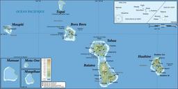
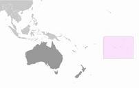
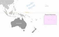
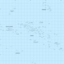
Map of French Polynesiafr.svg en Map of French Polynesia fr Carte de la Polynsie franaise Travail personnel own work clr Data sources Background map data from jpl nasa gov NASA Shuttle Radar Topography Mission SWDB public domain Softwares used NASA datas edited with GRASS GIS Vectorized with Inkscape Cartographic tutorials in french