
Related Images

Download:
| Tiny | 99x128 | View | Download |
| Small | 198x256 | View | Download |
| Medium | 396x512 | View | Download |
| Original svg | 558x721 | View | Download |
| Original as jpg | 558x721 | View | Download |
This image was acquired from
wikimedia. It was marked as Public Domain or CC0 and is free to use. To verify, go to the source and check the information there.
Looking for more info about this image?
Try a Google Reverse Image Search for it.
Try a Google Reverse Image Search for it.
Keywords from Image Description:
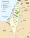
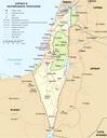
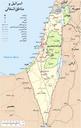
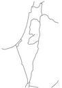
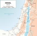
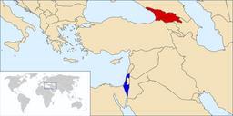
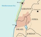
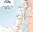
Map of Israel neighbours and occupied territories.svg en Map of the Middle East showing Israel Egypt Saudi Arabia Jordan Syria and Lebanon including Gaza Golan Heights and West Bank SVG extracted and edited from un org pdf PDF un org UN map SVG maps of Israel SVG maps of the Palestinian territories UN maps