
Related Images


This image was acquired from
wikimedia. It was marked as Public Domain or CC0 and is free to use. To verify, go to the source and check the information there.
Looking for more info about this image?
Try a Google Reverse Image Search for it.
Try a Google Reverse Image Search for it.
Keywords from Image Description:
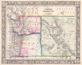
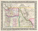
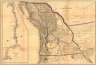
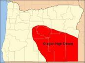
Map of Oregon High Desert Country. BadJPEG High Desert of Oregon in southeastern Oregon Covering much of Crook Deschutes Harney Lake and Malheur Counties in Oregon The moister northern High Desert region is part of the Columbia Plateau The dryer southern High Desert region is part of the Great Basin region of Oregon created this