Related Images


Download:
| Tiny | 169x128 | View | Download |
| Small | 338x256 | View | Download |
| Medium | 676x512 | View | Download |
| Large | 1352x1024 | View | Download |
| Original png | 2204x1669 | View | Download |
| Original as jpg | 2204x1669 | View | Download |
This image was acquired from
wikimedia. It was marked as Public Domain or CC0 and is free to use. To verify, go to the source and check the information there.
Looking for more info about this image?
Try a Google Reverse Image Search for it.
Try a Google Reverse Image Search for it.
Keywords from Image Description:
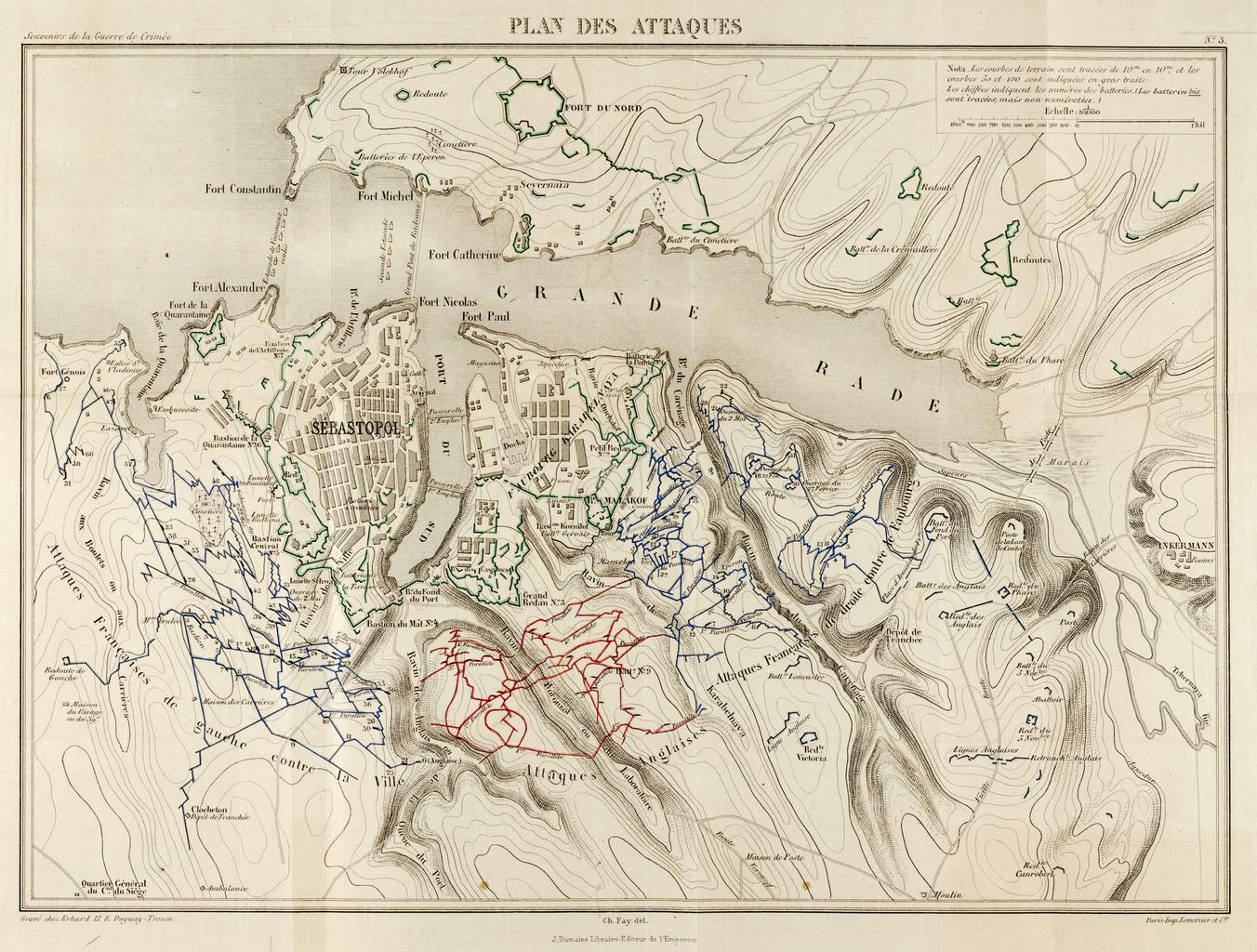
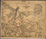
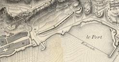
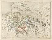
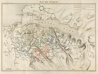
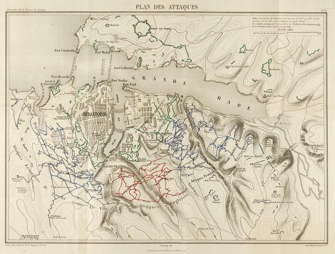
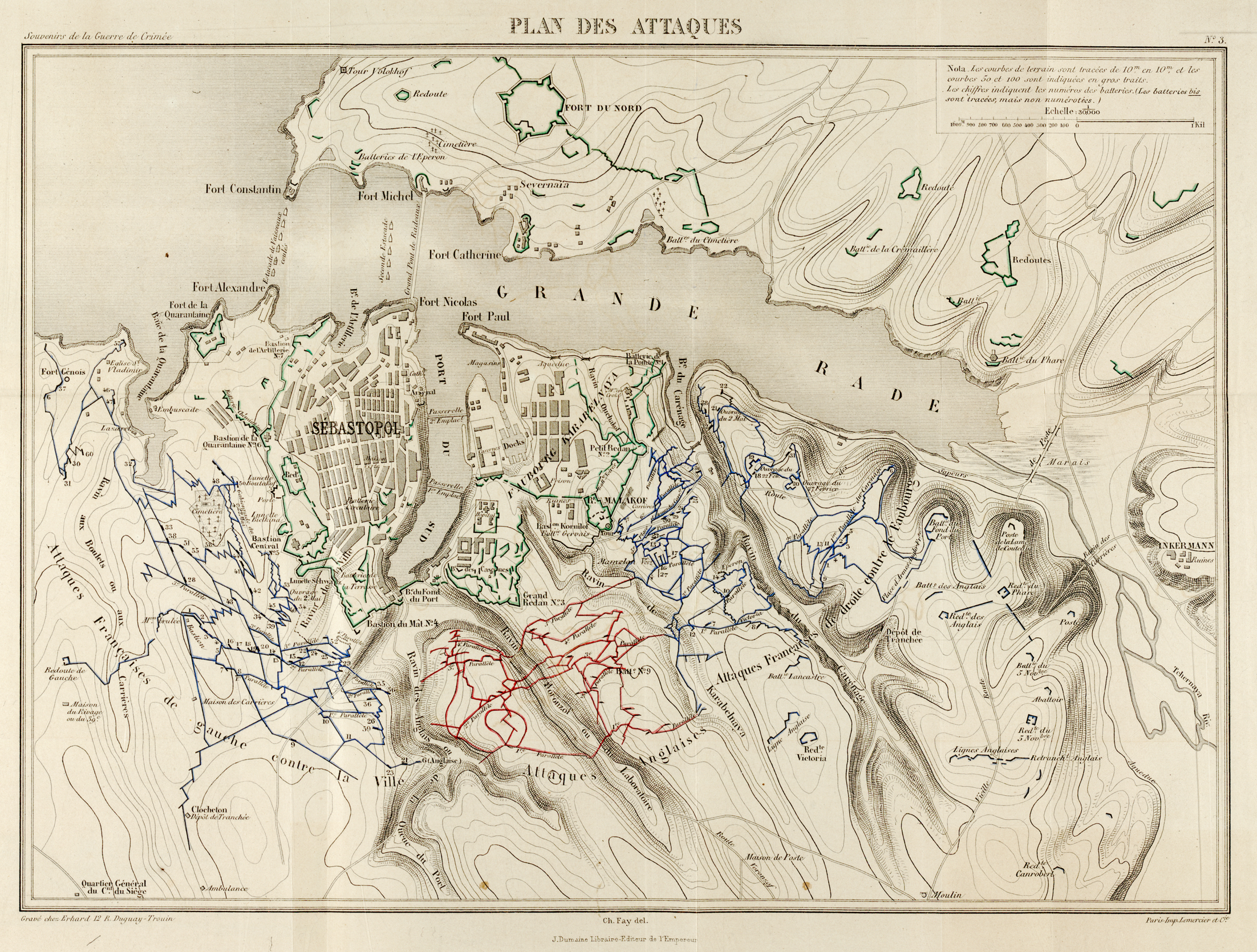
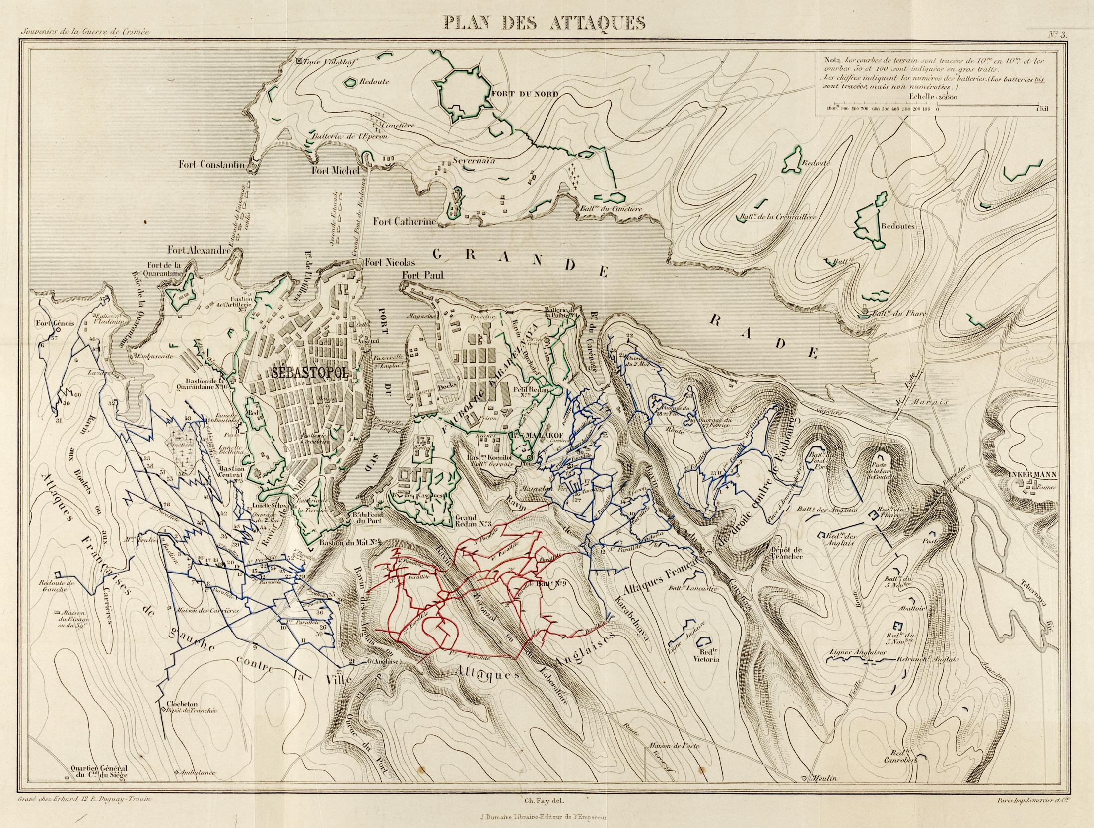
Map of Sebastopol lines . en Map of the French blue and English red positions at the en Siege of Sevastopol Contours intervals Detail from Plan des Attaques by Capitaine Charles Alexandre Fay French staff officer Published by Dumaine Imperial Librarian Paris Library of Congress source file linked below Charles Alexandre Fay PDold