
Related Images


Download:
| Tiny | 99x128 | View | Download |
| Small | 198x256 | View | Download |
| Medium | 397x512 | View | Download |
| Large | 794x1024 | View | Download |
| Original | 4131x5325 | View | Download |
This image was acquired from
wikimedia. It was marked as Public Domain or CC0 and is free to use. To verify, go to the source and check the information there.
Looking for more info about this image?
Try a Google Reverse Image Search for it.
Try a Google Reverse Image Search for it.
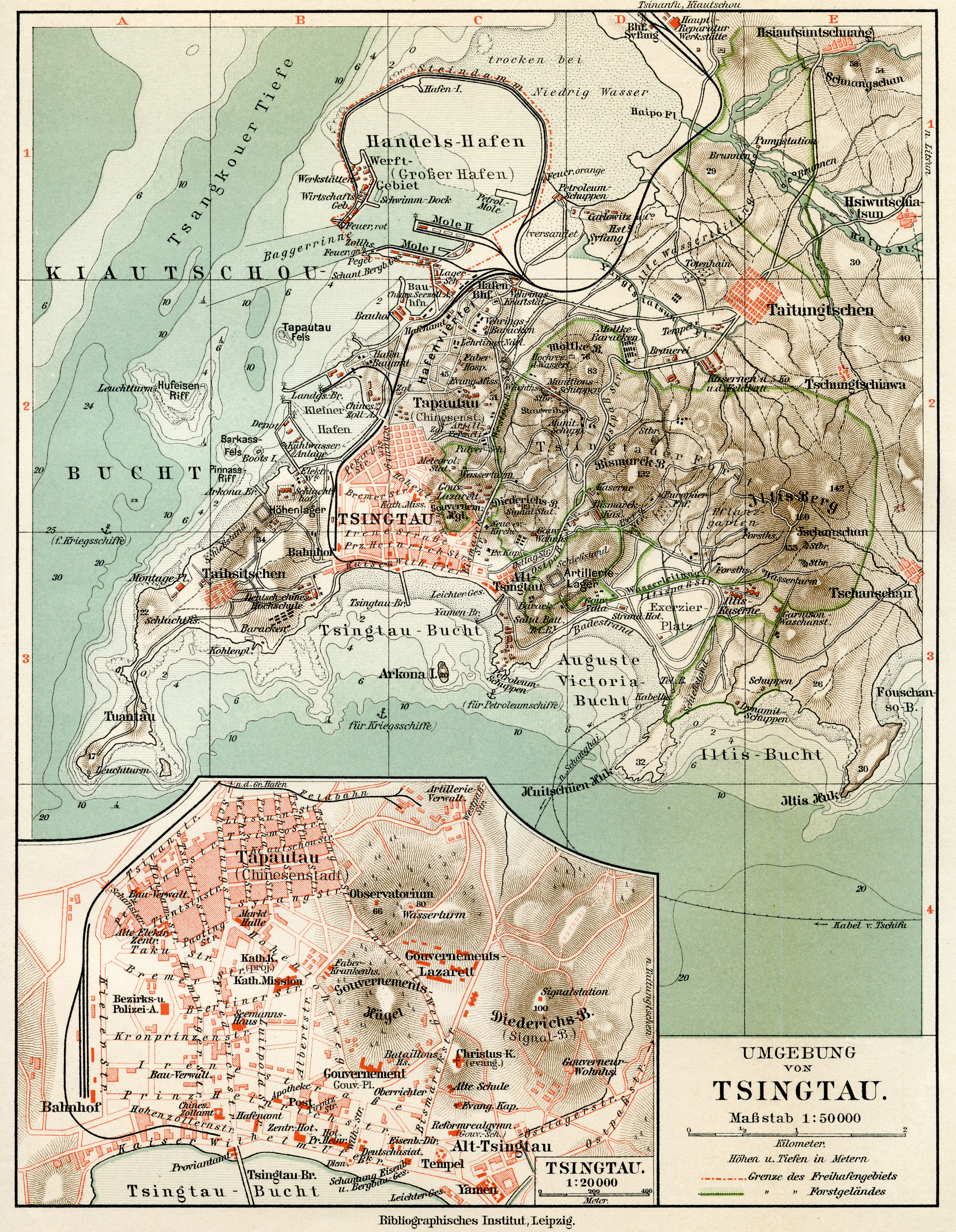
Keywords from Image Description:
Meyers Geographischer Handatlas Tsingtau. en Map of German colony of Tsingtau de Karte der deutschen Kolonie Tsingtau Meyers Geographischer Handatlas Leipzig th ed Till Niermann Scan PDold Kiautschou Maps of Qingdao Old maps of Shandong