Related Images


Download:
| Tiny | 181x128 | View | Download |
| Small | 362x256 | View | Download |
| Medium | 724x512 | View | Download |
| Large | 1449x1024 | View | Download |
| Original | 11686x8255 | View | Download |
This image was acquired from
wikimedia. It was marked as Public Domain or CC0 and is free to use. To verify, go to the source and check the information there.
Looking for more info about this image?
Try a Google Reverse Image Search for it.
Try a Google Reverse Image Search for it.
Keywords from Image Description:
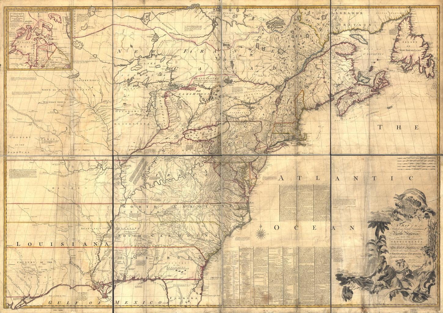
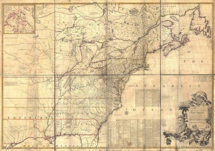
Mitchell Mapfull. LargeImage Mitchell Map map of the British and French dominions in North America loc gov gmd ar Library of Congress John Mitchell digital version Library of Congress Geography and Map Division The Library of Congress is providing access to these materials for educational and research purposes and is not aware