
Related Images
Download:
| Tiny | 46x128 | View | Download |
| Small | 93x256 | View | Download |
| Medium | 186x512 | View | Download |
| Large | 372x1024 | View | Download |
| Original | 1332x3664 | View | Download |
This image was acquired from
wikimedia. It was marked as Public Domain or CC0 and is free to use. To verify, go to the source and check the information there.
Looking for more info about this image?
Try a Google Reverse Image Search for it.
Try a Google Reverse Image Search for it.
Keywords from Image Description:
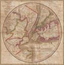
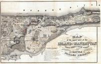
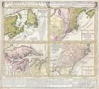
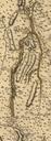
MontresorNewYorkStateDetail. Detail from map showing the area of upstate New York from the upper Hudson River near Fort Edward to Crown Point on Lake Champlain Creator John Montresor Published by Georges Louis Le Rouge LOCmap ar Other versions Military maps Old maps of the American Revolution Old maps of New York Lake Champlain