
Related Images


Download:
| Tiny | 157x128 | View | Download |
| Small | 315x256 | View | Download |
| Medium | 631x512 | View | Download |
| Large | 1262x1024 | View | Download |
| Original | 3500x2838 | View | Download |
This image was acquired from
wikimedia. It was marked as Public Domain or CC0 and is free to use. To verify, go to the source and check the information there.
Looking for more info about this image?
Try a Google Reverse Image Search for it.
Try a Google Reverse Image Search for it.
Keywords from Image Description:
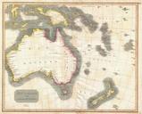
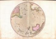
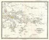
Spruner Map of Australia and Polynesia with an overview of Discoveries and Colonization Geographicus AustraliaPolynesiaspruner. This is Karl von Spruner historical map of Australia and Polynesia with an overview of discoveries and colonization Covers the area from Australia to California in the upper right corner and from China