
Related Images


Download:
| Tiny | 109x128 | View | Download |
| Small | 219x256 | View | Download |
| Medium | 439x512 | View | Download |
| Original svg | 621x723 | View | Download |
| Original as jpg | 621x723 | View | Download |
This image was acquired from
wikimedia. It was marked as Public Domain or CC0 and is free to use. To verify, go to the source and check the information there.
Looking for more info about this image?
Try a Google Reverse Image Search for it.
Try a Google Reverse Image Search for it.
Keywords from Image Description:
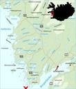
Myrar hnokki.svg Map of the region Myrar in western Iceland with several toponyms showing the location of the reef Hnokki south of lftanes where the research ship Pourquoi Pas of JeanBaptiste Charcot stranded on September own Akigka Image Myrar svg Map of Myrar Image Myrareldar svg Showing the extent of the fires of April Locator