Download:
| Tiny | 337x128 | View | Download |
| Small | 675x256 | View | Download |
| Original png | 1280x485 | View | Download |
| Original as jpg | 1280x485 | View | Download |
This image was acquired from
wikimedia. It was marked as Public Domain or CC0 and is free to use. To verify, go to the source and check the information there.
Looking for more info about this image?
Try a Google Reverse Image Search for it.
Try a Google Reverse Image Search for it.
Keywords from Image Description:
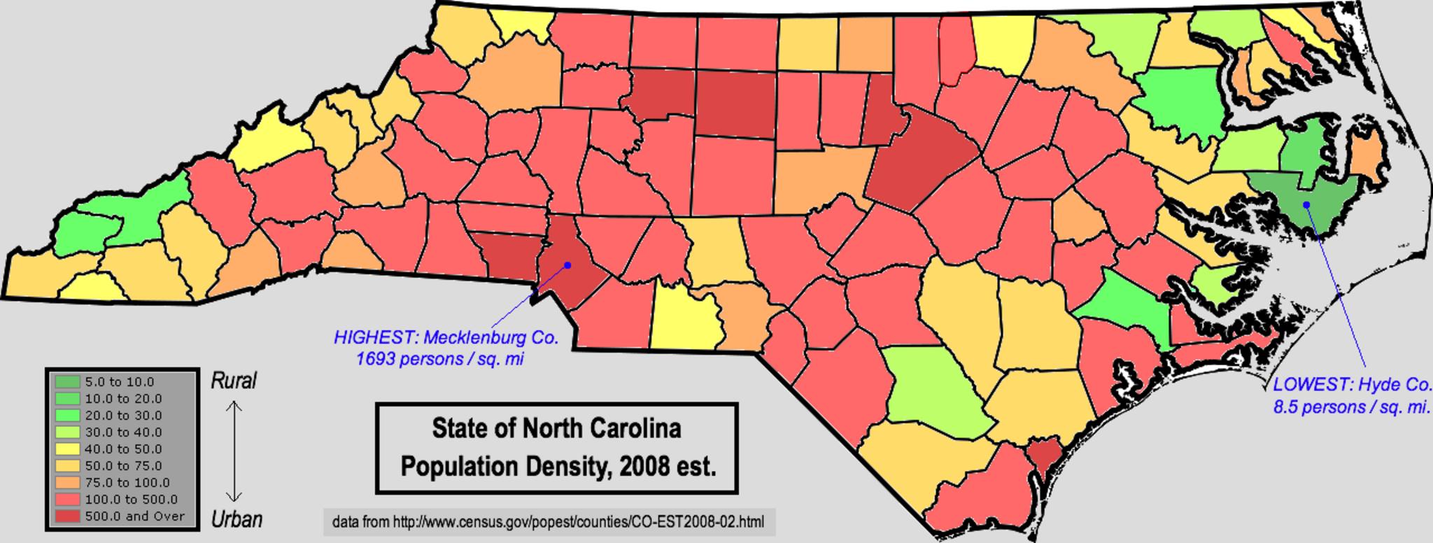
NorthCarolinaPopulationDensity. Map of North Carolina using color shading to denote countylevel population density using census estimates Data retrieved from census gov html Transferred from org en transferred to Commons by User Magnus Manske using de php CommonsHelper br Original text created this work entirely by myself
