
Related Images


Download:
| Tiny | 121x128 | View | Download |
| Small | 242x256 | View | Download |
| Medium | 484x512 | View | Download |
| Original png | 694x733 | View | Download |
| Original as jpg | 694x733 | View | Download |
This image was acquired from
wikimedia. It was marked as Public Domain or CC0 and is free to use. To verify, go to the source and check the information there.
Looking for more info about this image?
Try a Google Reverse Image Search for it.
Try a Google Reverse Image Search for it.
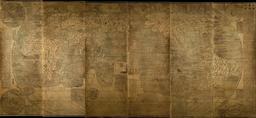
Keywords from Image Description:
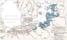
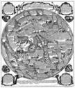
Ordensland. This map depicts German rule of North and Baltic Sea in th and early th century during the height of the Teutonic Order and the Hanseatic League Ordensstaat possessions until marked in blue colors with year of acquisition Lands of the bishoprics are marked with first letter Pomesanien Kulm Km Ermland Samland in Prussia