Related Images


Download:
| Tiny | 228x128 | View | Download |
| Small | 457x256 | View | Download |
| Original png | 898x502 | View | Download |
| Original as jpg | 898x502 | View | Download |
This image was acquired from
wikimedia. It was marked as Public Domain or CC0 and is free to use. To verify, go to the source and check the information there.
Looking for more info about this image?
Try a Google Reverse Image Search for it.
Try a Google Reverse Image Search for it.
Keywords from Image Description:
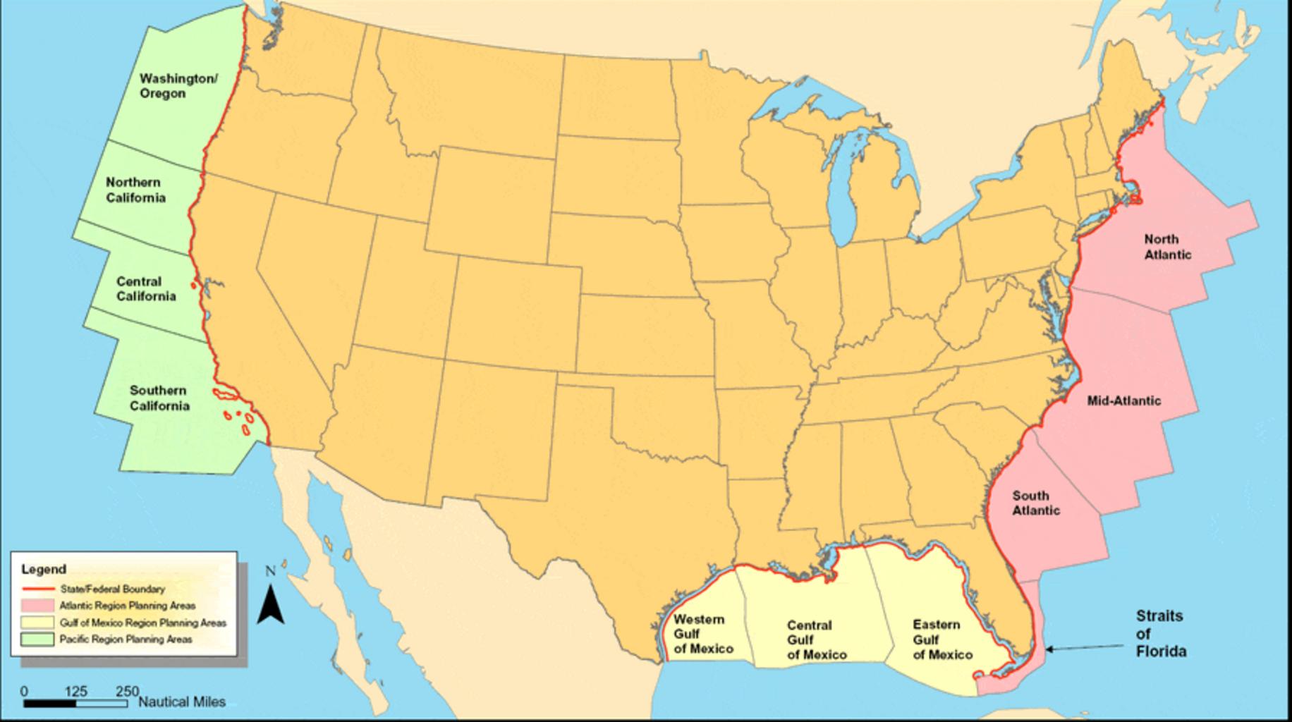
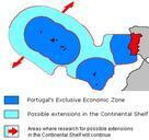
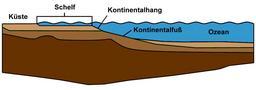
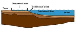
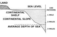
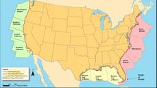
Outer Continental Shelf map. Map of Regional Planning Areas on the Outer Continental Shelf anl gov cfm OCS Alternative Energy and Alternate Use Programmatic EIS Information Center USA Federal Government PD anl gov Maps of the United States PDUSGov


