Related Images


Download:
| Tiny | 227x128 | View | Download |
| Small | 454x256 | View | Download |
| Medium | 908x512 | View | Download |
| Large | 1817x1024 | View | Download |
| Original | 4032x2272 | View | Download |
This image was acquired from
wikimedia. It was marked as Public Domain or CC0 and is free to use. To verify, go to the source and check the information there.
Looking for more info about this image?
Try a Google Reverse Image Search for it.
Try a Google Reverse Image Search for it.
Keywords from Image Description:
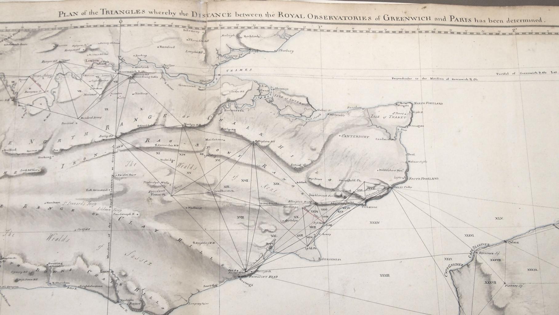
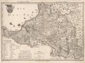
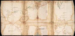
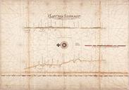
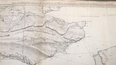
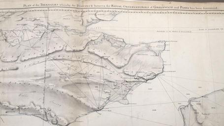
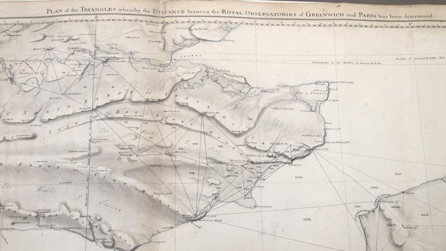
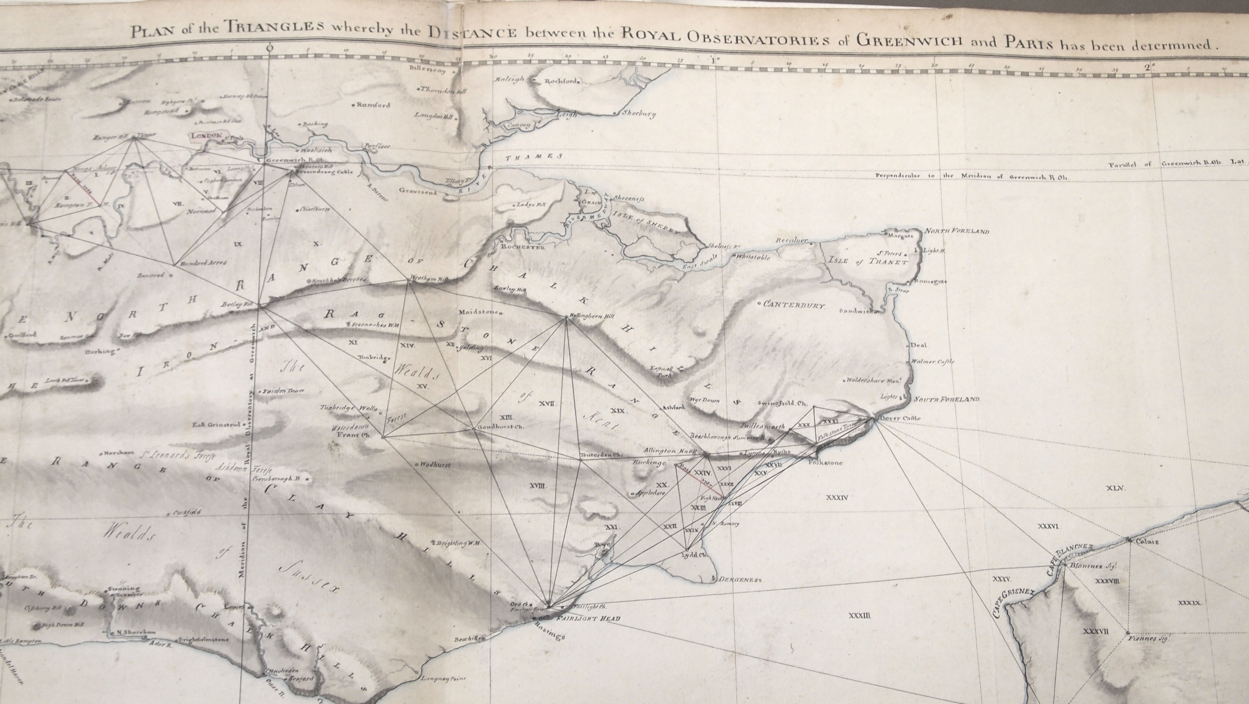
P adj. en Map showing the method of triangulation used by Major General William Roy FRS to determine the distance between the Paris and Greenwich observatories Royal Society Archives William Roy other versions Manuscript drawing was reproduced by copper etching in Philosophical Transactions of the Royal Society PDold Uploaded