
Related Images


Download:
| Tiny | 166x128 | View | Download |
| Small | 332x256 | View | Download |
| Original png | 650x501 | View | Download |
| Original as jpg | 650x501 | View | Download |
This image was acquired from
wikimedia. It was marked as Public Domain or CC0 and is free to use. To verify, go to the source and check the information there.
Looking for more info about this image?
Try a Google Reverse Image Search for it.
Try a Google Reverse Image Search for it.
Keywords from Image Description:
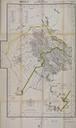
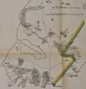
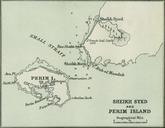
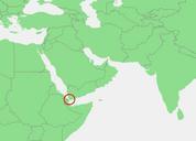
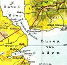
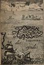
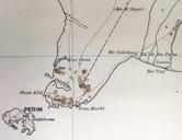
Perim and BabelMandeb Peninsula. en Detail of preWWI map showing Perim and the BabelMandeb Peninsula The thick doted line that starts at Husn Murad is the boundary line demarcating Ottoman Yemen on the west from the Aden Protectorate British on the east that was agreed upon by the AngloOttoman Boundary Commission in The mainland