Related Images


Download:
| Tiny | 259x128 | View | Download |
| Small | 518x256 | View | Download |
| Medium | 1036x512 | View | Download |
| Original png | 1704x842 | View | Download |
| Original as jpg | 1704x842 | View | Download |
This image was acquired from
wikimedia. It was marked as Public Domain or CC0 and is free to use. To verify, go to the source and check the information there.
Looking for more info about this image?
Try a Google Reverse Image Search for it.
Try a Google Reverse Image Search for it.
Keywords from Image Description:
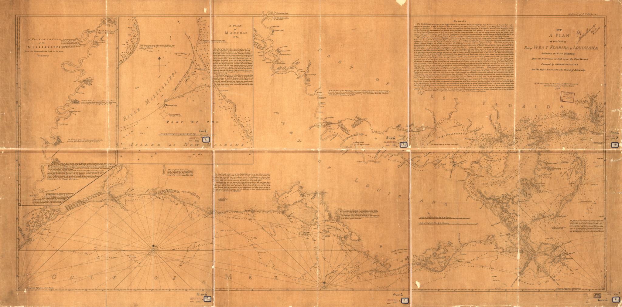
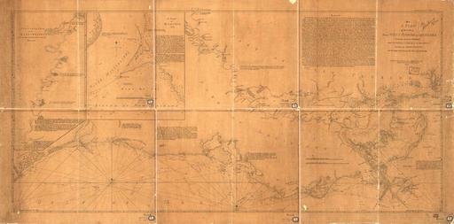
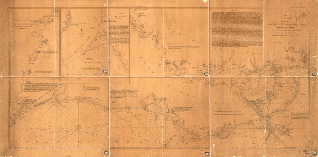
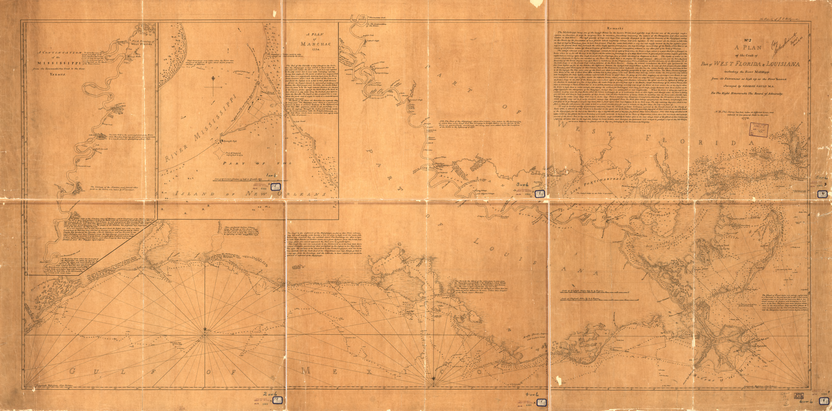
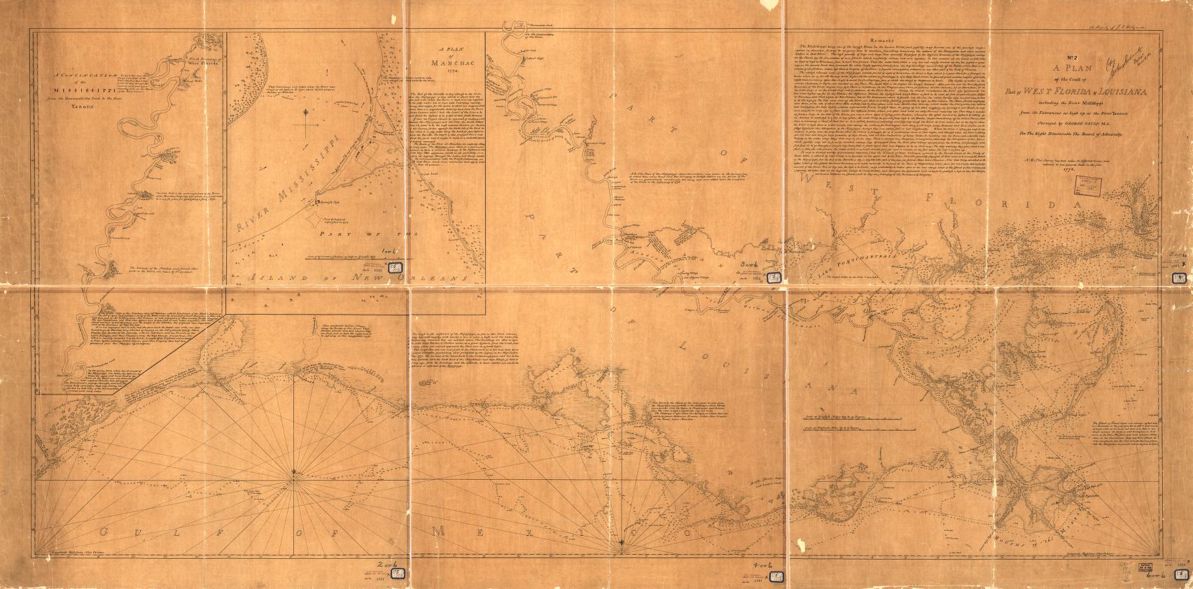
Plan of the coast Florida Louisiana . Plan of the coast of part of west Florida Louisiana including the River Yazous Surveyed by George Gauld for the Right Honourable the Board of Admiralty loc gov ammem field NUMBER band gcct The Library of Congress George Gauld PDUSGov maps Old maps of Florida Old maps of Louisiana Maps