
Related Images


Download:
| Tiny | 172x128 | View | Download |
| Small | 344x256 | View | Download |
| Medium | 689x512 | View | Download |
| Large | 1378x1024 | View | Download |
| Original | 2192x1628 | View | Download |
This image was acquired from
wikimedia. It was marked as Public Domain or CC0 and is free to use. To verify, go to the source and check the information there.
Looking for more info about this image?
Try a Google Reverse Image Search for it.
Try a Google Reverse Image Search for it.
Keywords from Image Description:
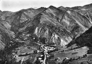
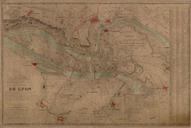
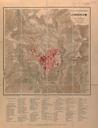
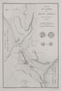
Plan topographique dtail MontdeLans. Plan topographique dtail de MontdeLans Dpartement de l'Isre MontdeLans Plan topographique expdi par adaptation du IGN et recollement et compltage sur le terrain Dress en par Thibaut chelle Thibaut gomtreesxpert Argenteuil PD PDscan MontdeLans Le Freneyd'Oisans Lac du Chambon