
Related Images


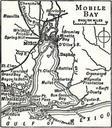

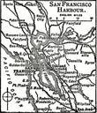
Download:
| Tiny | 180x128 | View | Download |
| Small | 360x256 | View | Download |
| Medium | 720x512 | View | Download |
| Original | 924x657 | View | Download |
This image was acquired from
wikimedia. It was marked as Public Domain or CC0 and is free to use. To verify, go to the source and check the information there.
Looking for more info about this image?
Try a Google Reverse Image Search for it.
Try a Google Reverse Image Search for it.
Keywords from Image Description:
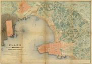
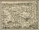
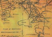
PlanoMontevideoSitioGrande. en Former map of Montevideo Uruguay and surrounding towns now converted into neighborhoods of the city developed during the called Guerra Grande Great War where the demarcation area occupied by the siege army of Montevideo es Mapa antiguo de Montevideo pueblos aledaos Pueblo de la Victoria actual barrio