Related Images

Download:
| Tiny | 139x128 | View | Download |
| Small | 279x256 | View | Download |
| Medium | 559x512 | View | Download |
| Original png | 994x910 | View | Download |
| Original as jpg | 994x910 | View | Download |
This image was acquired from
wikimedia. It was marked as Public Domain or CC0 and is free to use. To verify, go to the source and check the information there.
Looking for more info about this image?
Try a Google Reverse Image Search for it.
Try a Google Reverse Image Search for it.
Keywords from Image Description:
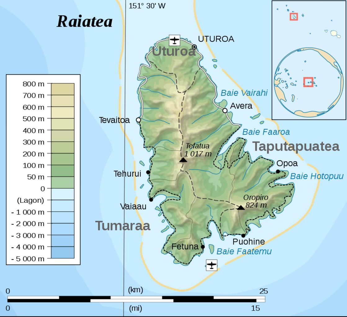
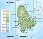
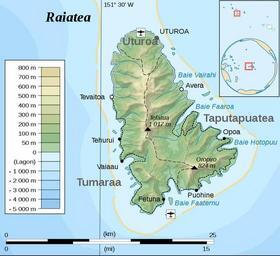
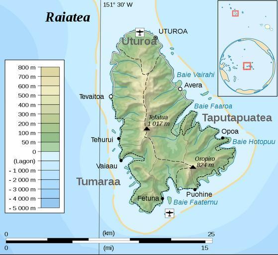
Raiatea topographic mapfr. Topographische Karte von Raiatea Gesellschaftsinseln FranzsischPolynesien Topographic map of Raiatea Society Islands French Polynesia own based on original from Sardon modified by Telim tor Tahaa and Raiatea topographic mapfr svg Raiatea topographic mapfr admin info grey Raiatea topographic map with