
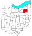
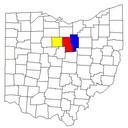
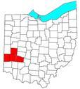
Related Images


Download:
| Tiny | 120x128 | View | Download |
| Small | 241x256 | View | Download |
| Medium | 483x512 | View | Download |
| Large | 966x1024 | View | Download |
| Original | 1567x1661 | View | Download |
This image was acquired from
wikimedia. It was marked as Public Domain or CC0 and is free to use. To verify, go to the source and check the information there.
Looking for more info about this image?
Try a Google Reverse Image Search for it.
Try a Google Reverse Image Search for it.
Keywords from Image Description:
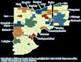
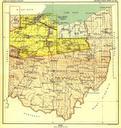
Royceareasohio. This th century map produced by the Smithsonian Institution depicts the major Native American land cessions that resulted in what is now Ohio From the publication Indian Land Cessions in the United States compiled by Charles Royce It was Part of the Eighteenth Annual Report of the Bureau of American Ethnology to