
Related Images


Download:
| Tiny | 230x128 | View | Download |
| Small | 461x256 | View | Download |
| Medium | 923x512 | View | Download |
| Original svg | 1152x639 | View | Download |
| Original as jpg | 1152x639 | View | Download |
This image was acquired from
wikimedia. It was marked as Public Domain or CC0 and is free to use. To verify, go to the source and check the information there.
Looking for more info about this image?
Try a Google Reverse Image Search for it.
Try a Google Reverse Image Search for it.
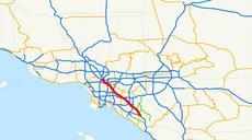
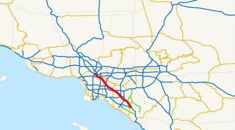
Keywords from Image Description:
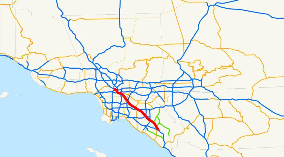
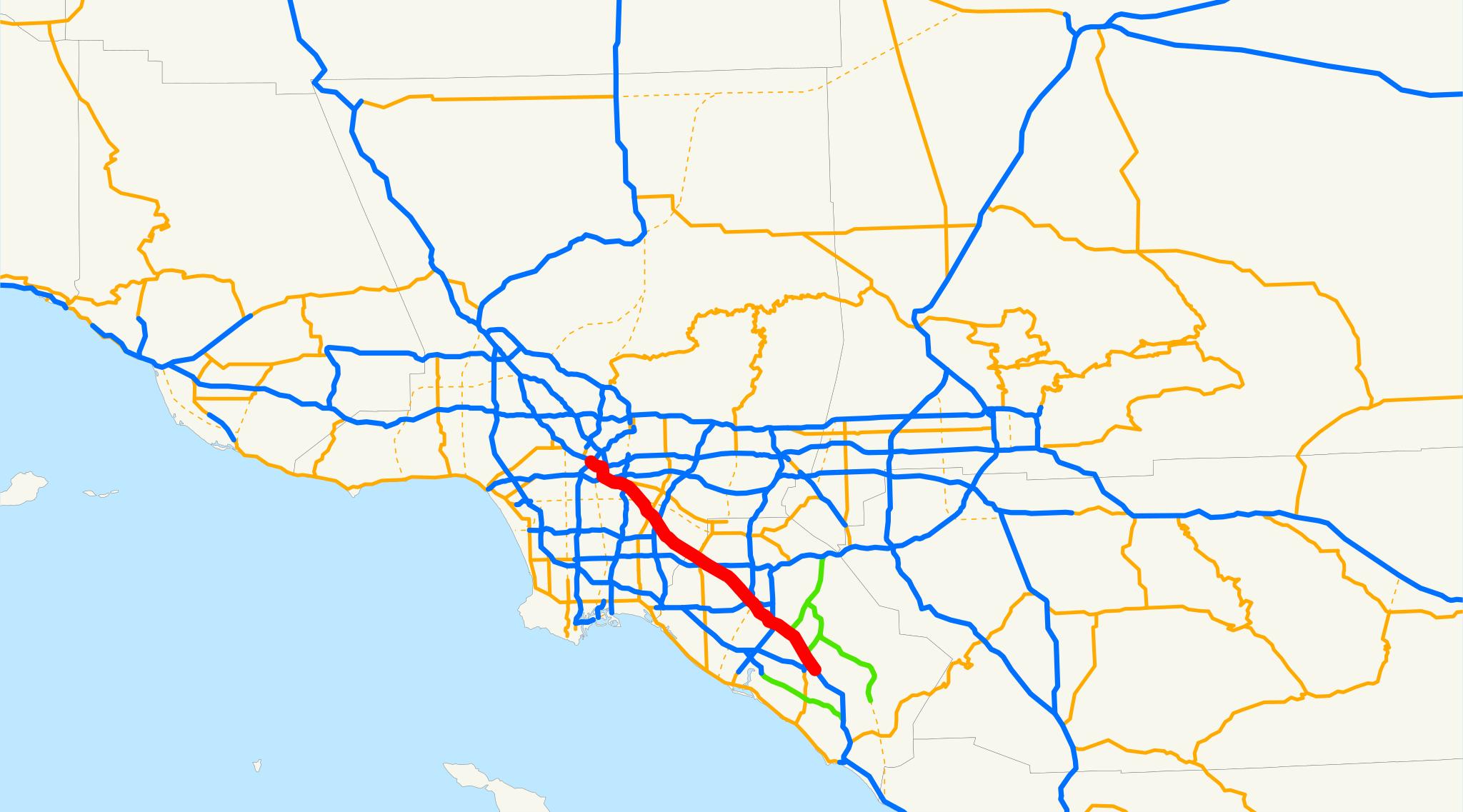
Santa Ana Freeway.svg Locator map of the Santa Ana Freeway in Los Angeles and Orange Counties Southern California The southern end of Route and southern section of Interstate in California between Downtown Los Angeles and Santa Ana at the 'El Toro Y' in Orange County Email me if you would like copy of the GIS data created for the