
Related Images


Download:
| Tiny | 158x128 | View | Download |
| Small | 317x256 | View | Download |
| Medium | 635x512 | View | Download |
| Large | 1271x1024 | View | Download |
| Original | 2933x2363 | View | Download |
This image was acquired from
wikimedia. It was marked as Public Domain or CC0 and is free to use. To verify, go to the source and check the information there.
Looking for more info about this image?
Try a Google Reverse Image Search for it.
Try a Google Reverse Image Search for it.
Keywords from Image Description:
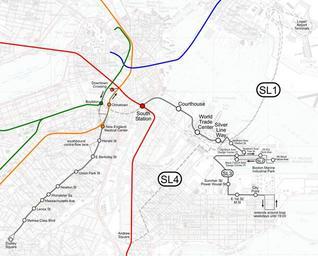
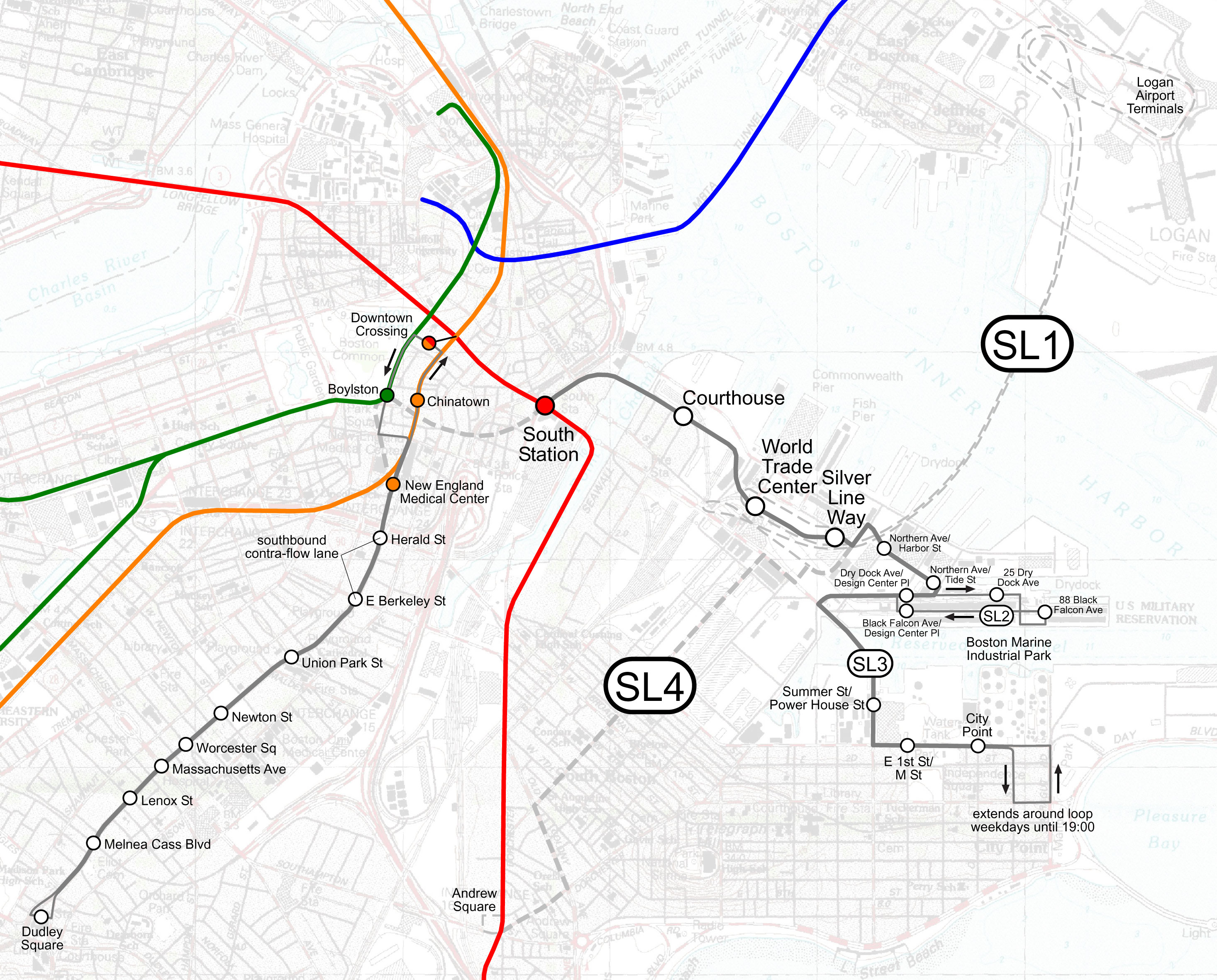
Silver Line. Map of Boston's Silver Line plans as of The SL route was discontinued in the Phase III tunnel and the SL service shown were never implemented Instead an SL service running on the surface to South Station was added User SPUI own over publicdomain USGS map background spuimap Maps of the MBTA Silver Line MBTA in