
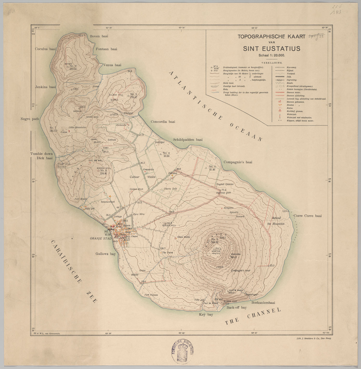
Related Images


Download:
| Tiny | 125x128 | View | Download |
| Small | 250x256 | View | Download |
| Medium | 500x512 | View | Download |
| Large | 1001x1024 | View | Download |
| Original | 1500x1534 | View | Download |
This image was acquired from
wikimedia. It was marked as Public Domain or CC0 and is free to use. To verify, go to the source and check the information there.
Looking for more info about this image?
Try a Google Reverse Image Search for it.
Try a Google Reverse Image Search for it.
Keywords from Image Description:
Sint Eustatius Map . en map of Sint Eustatius island of the Netherlands in the Caribbean Sea kb nl urn urn gvn KONB role image size variable geheugenvannederland nl Topographische Inrichting Den Haag Sint Eustatius Map Maps of Sint Eustatius maps History of the Netherlands Antilles PDold