
Related Images


Download:
| Tiny | 125x128 | View | Download |
| Small | 250x256 | View | Download |
| Medium | 501x512 | View | Download |
| Large | 1002x1024 | View | Download |
| Original | 1472x1504 | View | Download |
This image was acquired from
wikimedia. It was marked as Public Domain or CC0 and is free to use. To verify, go to the source and check the information there.
Looking for more info about this image?
Try a Google Reverse Image Search for it.
Try a Google Reverse Image Search for it.
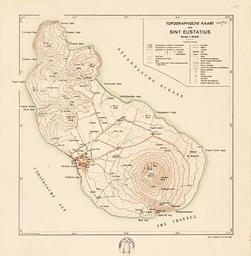
Keywords from Image Description:
Sint Eustatius Map B. de Karte von Sint Eustatius Insel der Niederlndischen Antillen Karibik en Map of Sint Eustatius island of the Dutch West Indies Caribbean fr Carte de SaintEustache le des Antilles nerlandaises Carabes nl Kaart van Sint Eustatius eiland van de Nederlandsch WestIndi Caribische Zee Sint Eustatius Map px Topographische