
Related Images


Download:
| Tiny | 224x128 | View | Download |
| Small | 449x256 | View | Download |
| Medium | 899x512 | View | Download |
| Large | 1799x1024 | View | Download |
| Original | 2362x1344 | View | Download |
This image was acquired from
wikimedia. It was marked as Public Domain or CC0 and is free to use. To verify, go to the source and check the information there.
Looking for more info about this image?
Try a Google Reverse Image Search for it.
Try a Google Reverse Image Search for it.
Keywords from Image Description:
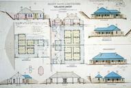
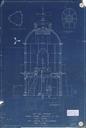
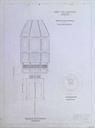
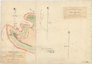
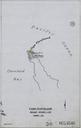
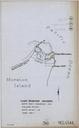
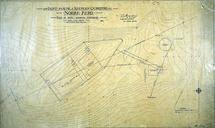
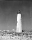
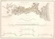
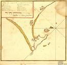
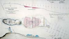
Smoky Cape Light plan of site . en Smoky Cape Light plan of site showing position of Buildings Area of Excavation Levels etc by James Barnet NSW Colonial Architect naa gov au asp James Barnet NSW Colonial Architect PDAustralia Smoky Cape Lighthouse Images from the National Archives of Australia Lighthouse maps