
Related Images


Download:
| Tiny | 87x128 | View | Download |
| Small | 175x256 | View | Download |
| Medium | 351x512 | View | Download |
| Large | 702x1024 | View | Download |
| Original png | 881x1285 | View | Download |
| Original as jpg | 881x1285 | View | Download |
This image was acquired from
wikimedia. It was marked as Public Domain or CC0 and is free to use. To verify, go to the source and check the information there.
Looking for more info about this image?
Try a Google Reverse Image Search for it.
Try a Google Reverse Image Search for it.
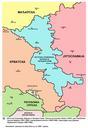
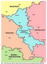
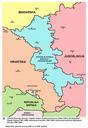
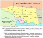
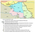
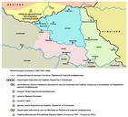
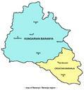
Keywords from Image Description:
Srem baranja. English Map of the Eastern Slavonia Baranja and Western Syrmia which was Serbian Autonomous Oblast part of the Republic of Serbian Krajina selfgoverning entity and UNadministered territory Borders presented in this map are from Srpskohrvatski Mapa podruja Istone Slavonije Baranje Zapadnog Srema koje je bilo Srpska